

000
ACPN50 PHFO 312312
TWOCP
Tropical Weather Outlook
NWS Central Pacific Hurricane Center Honolulu HI
Issued by NWS National Hurricane Center Miami FL
200 PM HST Mon Aug 31 2026
For the central North Pacific...between 140W and 180W:
Active Systems:
The National Hurricane Center is issuing advisories on Hurricane
Karina, located well west-southwest of the southern tip of the Baja
California Peninsula, and on Tropical Storm Lowell, located well
southeast of the Hawaiian Islands.
Central Pacific:
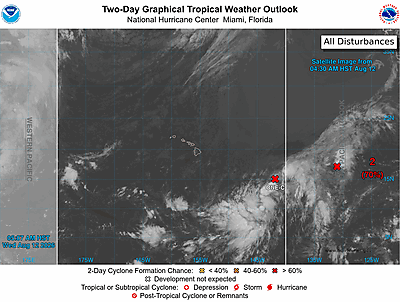
An area of showers and thunderstorms are located well south or
southwest of the Hawaiian Islands. Development of this system is
becoming less likely as it drifts slowly westward.
* Formation chance through 48 hours...low...near 0 percent.
* Formation chance through 7 days...low...10 percent.
&&
High Seas Forecasts issued by the National Weather Service
can be found under AWIPS header NFDHSFEPI, WMO header FZPN02
KWBC, and on the web at ocean.weather.gov/shtml/NFDHSFEPI.php
$$
Forecaster Evans/Kelly
NNNN