

000
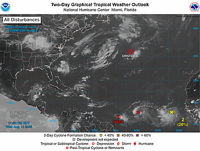
ABNT20 KNHC 292317
TWOAT
Tropical Weather Outlook
NWS National Hurricane Center Miami FL
800 PM EDT Sat Aug 29 2026
For the North Atlantic...Caribbean Sea and the Gulf of America:
East of the Leeward Islands (Remnants of Dolly):
Showers and thunderstorm continue in association with the remnants
of Tropical Storm Dolly, located about 150 miles east of the Leeward
Islands. However, there are no signs that the system is developing a
closed circulation. Redevelopment of this system is unlikely while
it moves westward to west-northwestward near 25 mph. The wave could
bring locally heavy rains and gusty winds to portions of the Leeward
Islands, the Virgin Islands and Puerto Rico over the next several
days.
* Formation chance through 48 hours...low...near 0 percent.
* Formation chance through 7 days...low...10 percent.
Northeastern and North-Central Gulf of America (AL97):
A weak low pressure area located around 125 miles south of
Pensacola, Florida is producing showers and thunderstorms. Some
additional slow development of this system is possible during the
next few days as it drifts westward across the northern Gulf.
* Formation chance through 48 hours...low...near 0 percent.
* Formation chance through 7 days...low...20 percent.
$$
Forecaster Adams