

000
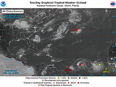
ABNT20 KNHC 110525
TWOAT
Tropical Weather Outlook
NWS National Hurricane Center Miami FL
200 AM EDT Sun Oct 11 2026
For the North Atlantic...Caribbean Sea and the Gulf of America:
Active Systems:
The Weather Prediction Center is issuing advisories on
Post-Tropical Cyclone Isaias, located inland over Tennessee.
Eastern Tropical Atlantic:
An elongated area of low pressure centered about 100 miles
southwest of the Cabo Verde Islands is producing a large but
disorganized area of showers and thunderstorms extending from
near those islands southward for several hundred miles. Some
development of this system is possible during the next couple of
days while the low north-northwestward before upper-level winds
become too strong for development by midweek. Very heavy rainfall
is also possible during the next few days over portions of the Cabo
Verde Islands regardless of whether the system ever becomes a
tropical cyclone.
* Formation chance through 48 hours...low...10 percent.
* Formation chance through 7 days...low...20 percent.
$$
Forecaster Blake