

000
ACPN50 PHFO 291126
TWOCP
Tropical Weather Outlook
NWS Central Pacific Hurricane Center Honolulu HI
Issued by NWS National Hurricane Center Miami FL
200 AM HST Tue Sep 29 2026
For the central North Pacific...between 140W and 180W:
Active Systems:
The National Hurricane Center is issuing advisories on Hurricane
Polo, near the Baja California Peninsula of Mexico, on Hurricane
Nolo, located several hundred miles west of Honolulu, Hawaii, and on
Tropical Storm Rachel, located few hundred miles south-southwest of
Lazaro Cardenas, Mexico.
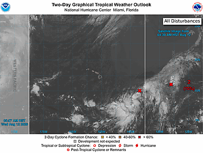
Well East-Southeast of the Hawaiian Islands (EP91):
An area of low pressure located well east-southeast of the Hawaiian
Islands is producing limited showers and thunderstorms this morning.
Only a slight increase in shower and thunderstorm organization is
needed for it to become a tropical depression during the next day or
two while it moves slowly east-northeastward. Environmental
conditions are expected to become less conducive for development
late this week.
* Formation chance through 48 hours...high...90 percent.
* Formation chance through 7 days...high...90 percent.
$$
Forecaster Kelly
NNNN